
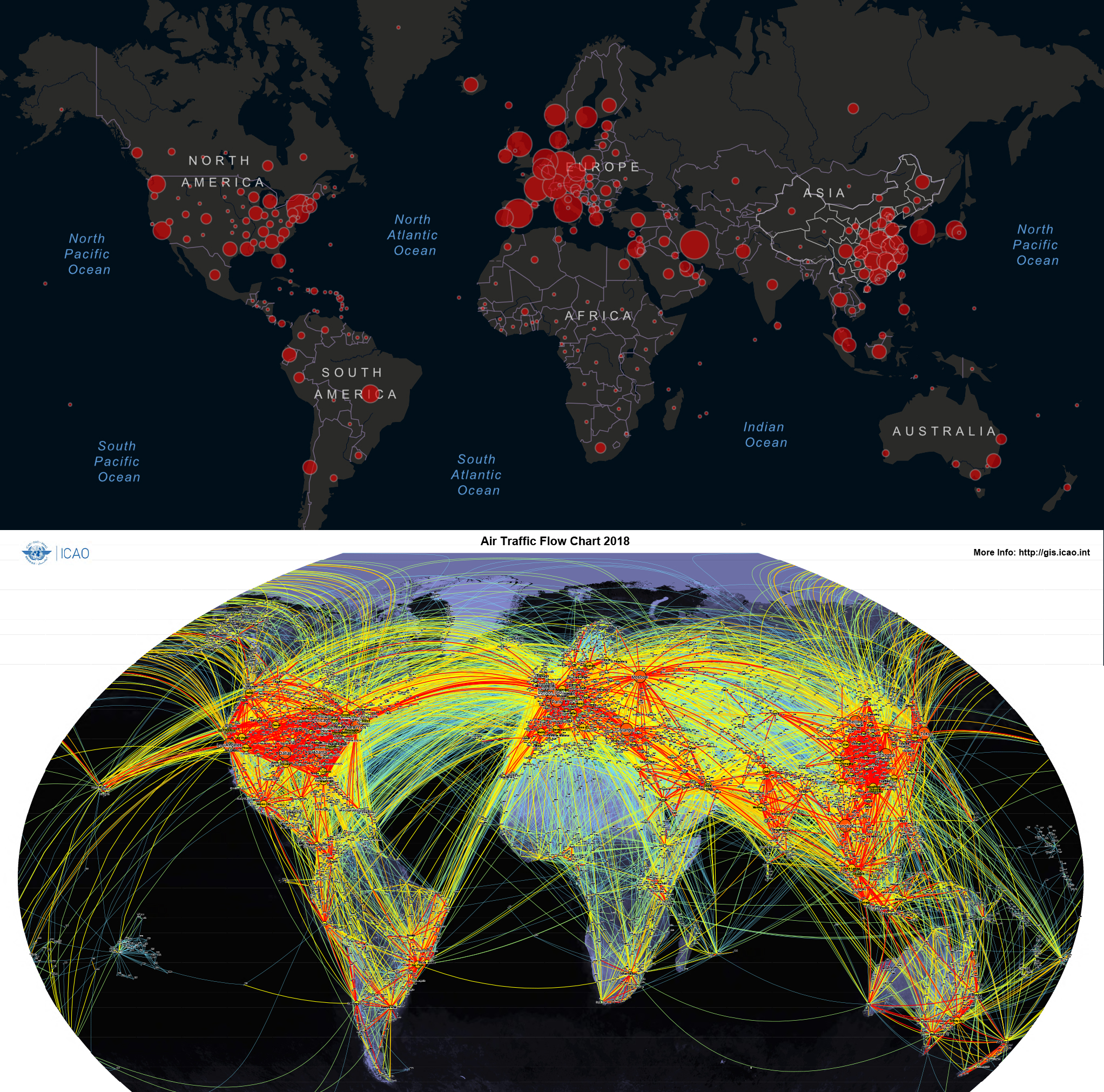
Sometimes a visual makes all the difference.
When you look at the spread of this particular virus and compare it to air traffic patterns and the most common and highly-used routes, it shouldn’t be surprising where infection starts. That’s why avoiding travel makes a lot of sense, doesn’t it.
That’s why no government should have been surprised by the first countries and cities to have reported cases.
Using data from:
https://gisanddata.maps.arcgis.com
and
https://gis.icao.int/gallery/